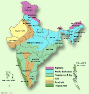
In my case, I am using India map, when a user clicks on any state it will show population for that state by district wise.
I have used the following image named india_map.jpg
1. Create a folder "images" in the following location and copy the above image in "images" folder.
D:\OracleBI\oc4j_bi\j2ee\home\applications\analytics\analytics
2. Then Restart the OC4J.
3. Check whether you are able to access the image using the following URL.
http://localhost:9704/analytics/images/india_map.jpg
In browser, if u get the image, then no issues with the image path. When you are not able to see the image, then there might be problem with the image path. Correct it and try again.
4. Consider the following criteria using the MAP table(in my example):

5. To add Image prompt, go to Prompts -> create prompt. Then select Image Prompt.

6. Fill the details as below.

Code which I have used for image map is :
<map id="india" name="india">
<area shape="poly" alt="Karnataka" coords="150,283,148,292,146,296,147,305,143,314,140,321,140,324,135,335,140,343,145,343,145,345,140,347,141,350,141,351,152,350,159,354,160,360,150,365,149,374,145,380,140,380,138,382,130,386,105,365,107,341,104,329,102,324,99,323,103,314,100,309,105,305,110,301,118,303,121,297,131,295,143,282" href="http://www.indiaonlinepages.com/population/karnataka-population.html" title="Karnataka" target="_blank" />
<area shape="poly" alt="Chennai" coords="143,380,144,386,148,393,153,401,154,406,159,412,162,417,167,422,169,413,173,408,178,408,182,404,180,397,179,386,188,366,187,353,176,361,170,363,167,361,165,365,162,367,151,368" href="http://www.census.tn.nic.in/" title="Chennai" target="_blank" />
<area shape="poly" alt="Goa" coords="91,320,100,323,102,328,100,330,99,332,96,332,93,330" href="http://www.citypopulation.de/India-Goa.html" title="Goa" />
<area shape="poly" alt="Kerala" coords="134,431,140,425,142,417,141,409,136,400,130,394,130,384,106,367,120,395,127,416" href="http://www.prokerala.com/kerala/population.htm" title="Kerala" target="_blank" />
<area shape="poly" alt="AP" coords="158,352,160,346,165,343,166,333,169,325,169,318,169,311,165,309,159,310,153,312,145,312,150,282,154,276,153,270,159,270,162,260,164,262,169,265,176,265,181,264,184,275,190,281,196,286,195,288,202,293,210,289,214,289,218,287,216,283,223,281,229,275,232,273,238,272,241,273,245,275,248,275,251,276,250,278,244,286,238,291,231,293,223,299,217,301,219,307,213,315,207,315,205,315,201,323,192,322,191,322,186,330,187,342,187,350,182,356,172,362,168,361,165,367,155,368,152,367,153,363,160,360" href="http://indiafacts.in/uncategorized/andhra-pradesh-districts-population-census-2011/" title="AP" />
<area shape="rect" alt = "india" coords = "0,0,443,473" href="http://updateox.com/india/district-wise-population-india-as-of-2011-census/" alt="" />
</map>
Then click on Extract Image Map from HTML.
7. Then fill the column name and value for the corresponding image area.

8. Click OK, Test Prompts and save it.
I have used the following image named india_map.jpg

1. Create a folder "images" in the following location and copy the above image in "images" folder.
D:\OracleBI\oc4j_bi\j2ee\home\applications\analytics\analytics
2. Then Restart the OC4J.
3. Check whether you are able to access the image using the following URL.
http://localhost:9704/analytics/images/india_map.jpg
In browser, if u get the image, then no issues with the image path. When you are not able to see the image, then there might be problem with the image path. Correct it and try again.
4. Consider the following criteria using the MAP table(in my example):

5. To add Image prompt, go to Prompts -> create prompt. Then select Image Prompt.

6. Fill the details as below.

Code which I have used for image map is :
<map id="india" name="india">
<area shape="poly" alt="Karnataka" coords="150,283,148,292,146,296,147,305,143,314,140,321,140,324,135,335,140,343,145,343,145,345,140,347,141,350,141,351,152,350,159,354,160,360,150,365,149,374,145,380,140,380,138,382,130,386,105,365,107,341,104,329,102,324,99,323,103,314,100,309,105,305,110,301,118,303,121,297,131,295,143,282" href="http://www.indiaonlinepages.com/population/karnataka-population.html" title="Karnataka" target="_blank" />
<area shape="poly" alt="Chennai" coords="143,380,144,386,148,393,153,401,154,406,159,412,162,417,167,422,169,413,173,408,178,408,182,404,180,397,179,386,188,366,187,353,176,361,170,363,167,361,165,365,162,367,151,368" href="http://www.census.tn.nic.in/" title="Chennai" target="_blank" />
<area shape="poly" alt="Goa" coords="91,320,100,323,102,328,100,330,99,332,96,332,93,330" href="http://www.citypopulation.de/India-Goa.html" title="Goa" />
<area shape="poly" alt="Kerala" coords="134,431,140,425,142,417,141,409,136,400,130,394,130,384,106,367,120,395,127,416" href="http://www.prokerala.com/kerala/population.htm" title="Kerala" target="_blank" />
<area shape="poly" alt="AP" coords="158,352,160,346,165,343,166,333,169,325,169,318,169,311,165,309,159,310,153,312,145,312,150,282,154,276,153,270,159,270,162,260,164,262,169,265,176,265,181,264,184,275,190,281,196,286,195,288,202,293,210,289,214,289,218,287,216,283,223,281,229,275,232,273,238,272,241,273,245,275,248,275,251,276,250,278,244,286,238,291,231,293,223,299,217,301,219,307,213,315,207,315,205,315,201,323,192,322,191,322,186,330,187,342,187,350,182,356,172,362,168,361,165,367,155,368,152,367,153,363,160,360" href="http://indiafacts.in/uncategorized/andhra-pradesh-districts-population-census-2011/" title="AP" />
<area shape="rect" alt = "india" coords = "0,0,443,473" href="http://updateox.com/india/district-wise-population-india-as-of-2011-census/" alt="" />
</map>
Then click on Extract Image Map from HTML.
7. Then fill the column name and value for the corresponding image area.

8. Click OK, Test Prompts and save it.
No comments:
Post a Comment
Thanks for your comment.